Monday, April 22, 2013
4/21/13 Schoodic Mtn. and Black Mtn. Cliffs
Sunny but a windy and cool start ( 30's) . After the rain and melting we wanted something that maybe wouldn't be too muddy so we headed for Schoodic. We parked in the Schoodic Beach parking lot ( no other cars) and head up the trail to Schoodic.
This is a pretty trail with easy wooded sections, steep rocky sections , and open ledge with views.
Here we can see the goal in the distance
Kelley beats me to the summit again
A view from the summit
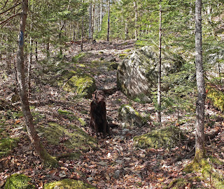
It doesn't have to be a lot of water
Are you coming?
We had our apple and then greeted a couple who arrived at the summit and headed down the traik to Donnell Pond and Schoodic Beach
We walked along the shore to the Black Mountain Trail.
It starts out easy but becomes steep in sections and seemed harder than Schoodic- but perhaps I was just tiring. I have seen trail descriptions that describe this section as ' Black mountain Cliffs' and talks about the views. We have only ever found glimpses through the trees though the walk along the ridge is quite nice.
We followed the trail back down to the parking lot and along the way I got this years first butterfly- this ones for you Grace. It seems a bit beat up for this early in the season.
Though we had met no other hikers besides the couple on Schoodic, there were seven other vehicles in the parking lot. A beautiful day and a nice hike. For Kelley there were some minor work arounds that she managed on her own but there were numerous streams flowing and I lost track of the number of times she got into them. 3 hours
Subscribe to:
Post Comments (Atom)


wow, nice views! And I love the shot of Kelley in the puddle. She can find water wherever you go!
ReplyDeleteThanks for your comment Linda- yes, she can and it's not because she's hot- it was cool and she had already been in several streams - she just loves water and now none of it is frozen.
DeleteHi, my husband and I will be visiting Maine once again in August. In 2011, we hiked up Schoodic Mt for the first time, and at that point Bangor Electric (?) had been doing a lot of work and trails were not marked at all... really, not at all. And we saw not a soul. I remember there are two ways in, and we apparently hiked in the harder way, from Hog Bay Rd, if I remember correctly. So... 2 questions:
ReplyDelete1) are trails marked better at this point?
2) coming in if you park at Schoodic Beach, is that way "easier" than if you went in from the Hog Bay Rd side?
Hi Jenn
ReplyDeleteWe have never done the trial from Hog Bay Rd. so I can't tell you anything about it. The trail from the Schoodic Beach parking is well marked and easy to follow as it gets a fair amount of use. For a shorter loop than the one above you can hike down to the beach and then take the trail back to the parking area. If you email me I will send you a bit larger maps.