The Rest of Our Hiking Pictures Can Be Found Here

Finding Trail Descriptions

So as not to repeat myself excessively, I am reducing the amount of description of trails that have already been posted. Please use the search function ( upper left) to find older posts which have more detailed trail descriptions and pictures. You can also use this to find specific hikes either by trail or mountain.


Click Pictures for a Larger View


Thursday, October 16, 2014

10/15/14 Tunk Mountain


Cloudy but 60's and supposed to rain the next two days so we wanted to get in a good one today.

We started from the trailhead off Myrick Pond Rd. To get too it you have a walk up a road that is worse then the one that got you to where you parked. Near the trailhead is a  small pond


The trail starts as an old woods road before becoming a single track.


and is a steady climb to the ridge but has no difficulties for Kelley. When you come out of the woods onto the ridge you suddenly have nice views


There were also some pretty leaves


Though we have done this hike many times we missed a sort of path over to the other side of the mountain.
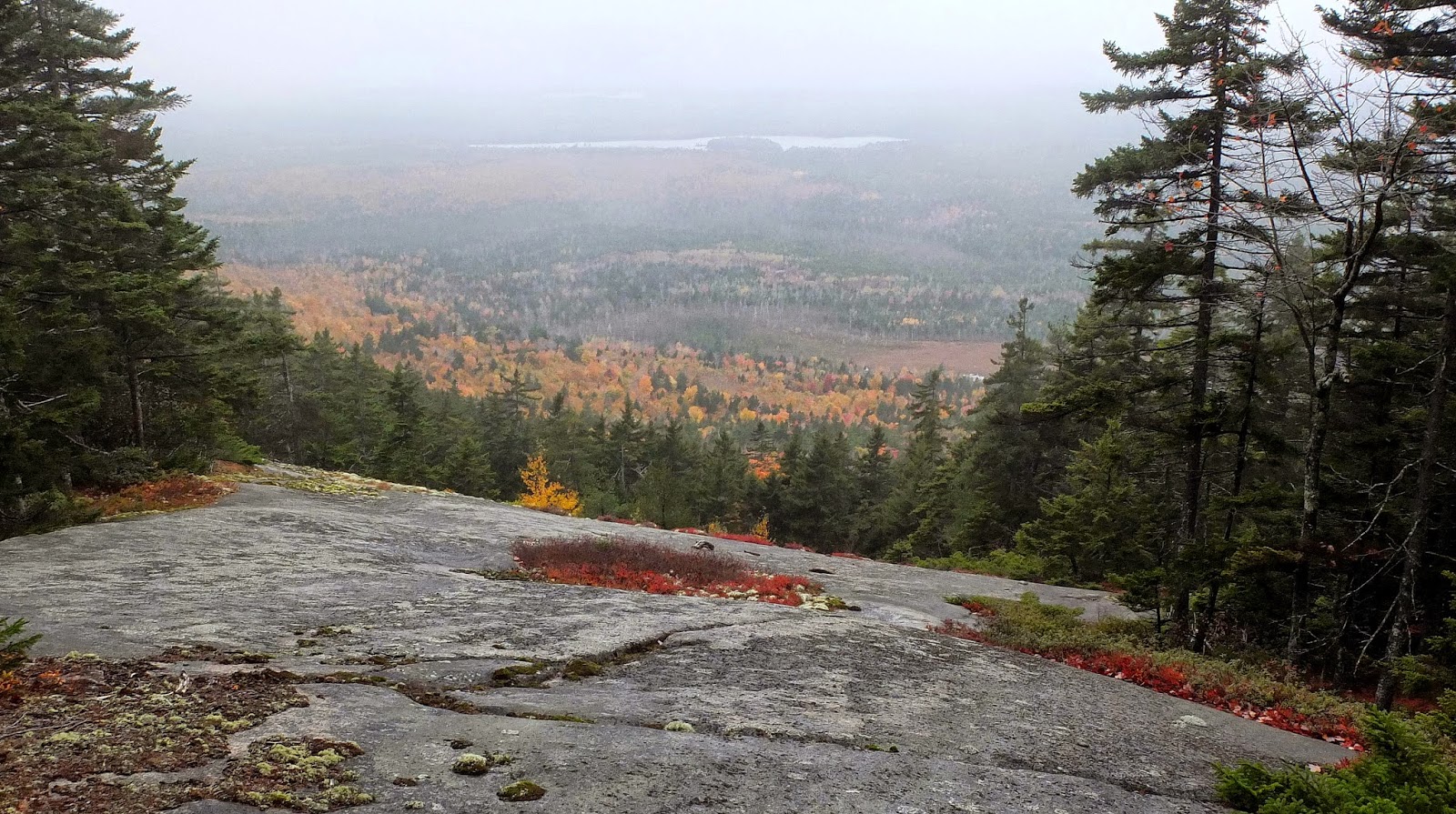


A pano shot- please click for larger view

Tunk Mt. Trail View  10-15-14


A section of the trail along the ridge


We hiked to where the trail turns down to the ponds and then returned the way we had come.The ridge part has a couple of spots Kelley needs to work around but nothing really difficult. More leaves on the way down


Of course we stopped at the pond on the way out and while Kelley was in the water I walked back to see if I could get a better view


A nice hike with comfortable temps , views, and fall colors. 2  1/2 hours 

Wednesday, October 15, 2014

10/14/14 Sunkhaze Redux


Another nice day to explore an area  that has been a problem for us on several occasions . Yesterday we found a trailhead we returned to explore. We were hoping it would be the trail shown on the map as Buzzy Brook South . We have never been able to follow that trail from either end or even be sure we were on it - no blazes or signs on these unmaintained trails.

The McLaughlin Rd.


 which we walked to this trailhead


Going by the sun it seemed to be a fairly straight shot. It was in poor condition and you would not be able to ski it. One of the better sections ( there were also many trees down across the trail which meant leaving the trail to get around them ) .


We followed the trail for a fair distance and then it took a short jag onto another trail, which we followed.  On the map above I have drawn an approximation of the route we followed. Eventually the trail just petered out without reaching either Buzzy Brook or S. Buzzy Brook. We looked around the woods for another trail or a continuation - flagging our route -  but could find nothing and so returned the way we had come. When we got to the jag we followed the other trail as it seemed to be going in the right direction and it brought us back to the place we had started from .???  These trails continue to mystify me .

There had been no water along these trails - another time we wandered around the area lost and kept running into water - so I decided we would continue up the road to where the map shows  Little Buzzy Brook crossed the road. Well, not exactly  - on the right was a beaver pond which had also flooded part of the road and on the other side of the road only a trickle of water. Kelley was happy


The lodge


We stayed long enough for Kelley to get in several times and me to take some pictures and then headed back. Another puzzling attempt with no solution but a good outing anyway.  2  1/4 hours 

Tuesday, October 14, 2014

10/13/14 Buzzy Brook at Sunkhaze


Another nice fall day  sunny 50's . Someplace we haven't been in awhile. This part of the refuge has trails that are mostly old woods roads and there are others that are not on the maps. It can be confusing.


This trail is often quite wet as the refuge protects a large peat bog and there is little elevation. Today it was muddy but only one pool of water for Kelley until we reached the brook.

Click for larger view

Buzzy Brook pano 10-13-14


We returned via the other side of the loop which is actually a little easier and less muddy,


When we got back to the McLaughlin Rd. ( supposedly used by logging trucks at times but we have never encountered any vehicles- it's also gated ) we continued on a ways looking for the S. Buzzy Brook Trail which we have had problems finding and following in the past. We found a trail but it was not named and we will return tomorrow and explore further. A nice time in the fall woods 2  1/2 hours 

Monday, October 13, 2014

10-12-14 Sheepscot Headwaters Trails


Cool - 48 to 52 but sunny and fine once we got moving. Another pretty day in the woods and an easy one for Kelley. Most of the small streams had enough water for Kelley to get into - last time we were here they were all dry.

We followed the route shown above - was considering adding Hogback ( #13)  but when we got to that junction decided that might be too much for Kelley, though she was not showing any signs of lameness and was very enthusiastic about the hike, running ahead of me most of the time.

This is basically a pretty woods walk.

Hemlock Hollow Trail


Bog Brook Trail


Small pano of a meadow just off the trail- click for larger view

Meadow - Sheepscot Headwaters Trails  10-12-14

Almost back- Whitten Hill Trail


Another really nice day- we are getting spoiled by this continued mild weather.  2  1/2 hours

Saturday, October 11, 2014

10/10/14 Frye Mountain


Another beautiful day- much like yesterday but with less wind. Decide to do Frye but not by our usual route.Were going to take the Loop Trail and see if we could find the trail up the side of the mountain but when we started down I realized I had forgot how steep it could be and the distances were going to be longer than I wanted for Kelley.Back to our usual route up the mountain. Then down the side and walked the road for awhile. Kelley seemed happy with that but when we passed an old woods road,we had not taken , but seemed to cross the trail we went that way. We went for some ways without finding the trail and eventually reached some private property. Now I was sure we were off track and after looking a bit for another trail we returned the way we had come and found the trail - we had missed it on the way out - and took that back to the trailhead.  Kelley had been enthusiastic for the whole hike. There was some water and we met one hiker coming down from the mountain as we were going up. We then met a man at the kiosk at the trail head and chatted about local trails for a bit before heading to the car.

I didn't take many pictures but enjoyed a beautiful day in the woods.


First stream


Part of the trail


Most of the trail is fairly dense woods and there was not a lot of color - the summit is open ( though no views) and was colorful


Remnant of the old fire tower


Coming down off the mountain


A really nice day but my error on the woods road made the hike 3  1/2 hours long which I had not wanted. That night Kelley showed a little lameness so tomorrow we will have a rest day- supposed to be cold and gray anyway. 

Friday, October 10, 2014

10/9/14 Partridge and Ducktail Ponds


Yesterday it rained all morning and in the afternoon we just did a walk around the neighborhood. Today is beautiful- sunny and 50's - also quite windy which we could have passed on.

A beautiful day to be in the woods- near the start of the trail


You can keep going north west  after the trail turns for Partridge Pond. I have added it to the map above. Not long after the turn off you come to an old bridge which I always think may not support me. Today my first step caused me to slip and fall off the bridge- no harm to me or camera.


On to the northern end of the pond


A couple of pictures and a swim for Kelley and we went back and took the trail to Partridge


A pano of a closer view of the trees- please click

Partridge  Ponds pano 10-9-14


Then back to take the trail to Ducktail


A very nice day all around. Because of the recent rain, the small streams and pools that had been dry the last time we were here had water and Kelley was happy about that.  2  1/2 hours 

Wednesday, October 8, 2014

10/7/14 Stillwater River Trail


Gray morning with rain forecast for today and tomorrow  Also wanted something easy after yesterday's somewhat rigorous hike. This is a pleasant little trail that runs along the river from downtown Orono and gives Kelley several opportunities to get in the river.


A pano shot- click for larger version

Stillwater River pano 10-7-14

Some nice birches


 and a shot of a piece of the hillside


Near the end of the trail there was huge flock of Canada Geese in the water ( the picture shows only part of the flock)


Kelley got into the water anyway and the geese were unconcerned- in fact some swam closer to check her ( or me) out


A pleasant little hour and a half.walk - we even got a bit of sun which did not last.